Natural resource management (NRM) has always been crucial for sustainable development and environmental conservation. With the advent of advanced technologies, the field has witnessed transformative changes, particularly through geospatial technology. This article explores the impact of geospatial technology on natural resource management, highlighting its benefits, applications, and future potential.
Understanding Geospatial Technology
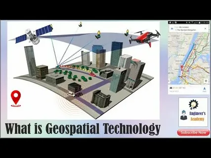
Geospatial technology refers to tools and techniques used to collect, analyze, and visualize geographic data. These include Geographic Information Systems (GIS), Remote Sensing (RS), Global Positioning Systems (GPS), and other mapping technologies. These tools allow for precise data gathering on land, water, vegetation, and other natural resources, enabling better decision-making and planning.
Enhancing Natural Resource Mapping and Monitoring
One of the most significant ways the impact of geospatial technology on natural resource management is felt is through enhanced mapping and monitoring. Traditional methods of resource assessment were often time-consuming and prone to errors. Today, satellite imagery and GIS provide real-time data on forest cover, water bodies, mineral deposits, and wildlife habitats.
This technology aids in tracking changes in natural resources, such as deforestation, soil erosion, and water quality degradation. By monitoring these changes, resource managers can implement timely interventions to mitigate adverse effects and promote sustainable use.
Improving Resource Allocation and Planning
Effective management of natural resources requires accurate spatial information to allocate resources efficiently. Geospatial technology helps planners understand resource distribution and availability, supporting better land use planning and resource allocation. For instance, GIS helps in identifying areas suitable for agriculture, forestry, or conservation, balancing economic needs with ecological preservation.
Moreover, the ability to analyze multiple layers of data—such as soil type, rainfall patterns, and topography—allows for integrated resource management strategies that consider environmental, social, and economic factors.
Facilitating Disaster Management and Climate Resilience
The impact of geospatial technology on natural resource management extends to disaster management and climate resilience. By mapping vulnerable areas prone to floods, droughts, or wildfires, resource managers and policymakers can develop proactive strategies to protect natural resources and communities.
Geospatial data supports climate change models, helping predict future scenarios and enabling adaptation measures. This integration is vital for preserving biodiversity and ensuring the sustainable use of resources in the face of changing climatic conditions.
Future Prospects and Challenges
As geospatial technology continues to evolve, its role in natural resource management is expected to grow. Advances in artificial intelligence and machine learning, combined with geospatial data, will provide even more accurate predictions and management solutions.
However, challenges such as data accessibility, technical expertise, and cost need to be addressed to maximize the benefits. Collaborative efforts among governments, researchers, and communities are essential to harness the full potential of these technologies.
Conclusion
In conclusion, the impact of geospatial technology on natural resource management is profound and multifaceted. It enhances the ability to map, monitor, plan, and protect vital resources, ensuring sustainability for future generations. As these technologies advance, they will continue to play a pivotal role in safeguarding our natural environment and supporting sustainable development goals.


